
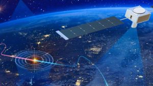
Satellite sensors are specialized instruments mounted on satellites, actively detecting and measuring various energy forms or phenomena from afar. Unlike groundbased equipment, these sensors operate in space’s harsh environment, enduring extreme temperatures, radiation, and vacuum conditions. They function by capturing electromagnetic radiation, such as light or radio waves, reflected or emitted by Earth’s surface, atmosphere, or other celestial bodies.
The core of satellite sensor technology is remote sensing. This process actively gathers data without physical contact, enabling satellites to efficiently monitor vast areas. Key features include spectral resolution (the ability to distinguish different wavelengths), spatial resolution (the level of detail in images), and temporal resolution (the frequency of data collection).
Sensors in satellites are broadly divided into two categories: passive and active. Each type employs unique mechanisms, tailored for specific tasks, ensuring versatility in space observation.
Passive Sensors
Passive satellite sensors rely on natural energy sources, primarily sunlight, to detect reflected or emitted radiation. They conserve energy and are commonly used for optical imaging.
Optical sensors: These actively capture visible light and nearinfrared wavelengths, producing photolike images.
Infrared sensors: They focus on thermal radiation, detecting heat signatures. These are vital for monitoring sea surface temperatures or identifying forest fires.
Hyperspectral sensors: Advanced versions capture hundreds of narrow spectral bands, enabling detailed material identification, such as mineral mapping or pollution detection.
Active Sensors
Active satellite sensors emit their own energy signals and measure the echo or reflection. This allows them to operate day or night, regardless of weather conditions.
Radar sensors (microwave): Using radio waves, Synthetic Aperture Radar (SAR) systems, like Sentinel1, penetrate clouds for terrain mapping or oil spill detection. They are critical in disaster response for floodprone areas.
LIDAR sensors: Laserbased systems measure distances by sending light pulses.
Altimeter sensors: These determine sea level height by measuring radar or laser pulse return times, supporting oceanography and navigation.
The versatility of sensors in satellites drives their widespread use across industries, transforming how we interact with Earth.
Environmental monitoring: Satellite sensors track deforestation, air quality, and biodiversity. For instance, optical sensors monitor coral reef health, while infrared sensors detect greenhouse gas emissions.
Disaster management: During natural disasters, active sensors like SAR provide realtime imagery, assessing earthquake or hurricane damage to aid swift humanitarian response.
Agriculture and resource management: Hyperspectral sensors analyze soil moisture and crop health, optimizing farming practices and predicting yields.
Military and security: Highresolution satellite sensors support reconnaissance, border surveillance, and missile detection, strengthening national defense strategies.
Scientific research: Beyond Earth, sensors on Mars rovers study planetary atmospheres, advancing astrobiology and space exploration.
Send us a message,we will answer your email shortly!
TY-Space Technology (Beijing) Ltd. is professional focusing on advanced attitude optical sensors, especially Star Trackers for space industry.