
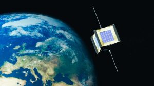
Satellite sensors form the core of remote sensing, actively collecting data from a distance without physical contact. They operate across various electromagnetic spectrum bands, capturing signals from visible light to microwaves. With advancements in miniaturization and cost reduction, modern satellites, like CubeSats and small satellites, now carry sensors rivaling large platforms in performance.
Optical Sensors
Optical sensors rank among the most common in Earth observation satellites. They actively detect visible light, nearinfrared, and sometimes ultraviolet signals, producing photolike images with rich details.
Panchromatic Sensors: These capture broadspectrum blackandwhite images, delivering high spatial resolution for clear details.
Multispectral Sensors: They split light into multiple bands (e.g., red, green, blue, nearinfrared), enabling analysis of vegetation health, soil types, and water quality.
Hyperspectral Sensors: As advanced variants, they capture hundreds of narrow spectral bands, precisely identifying materials.
Radar Sensors
For allweather, dayandnight observations, radar sensors prove essential. They actively emit microwave signals, penetrating clouds, fog, or vegetation.
Synthetic Aperture Radar (SAR): By synthesizing signals over time to mimic a large antenna, SAR achieves highresolution imaging without bulky hardware.
Radar sensors play a critical role in ocean surveillance, oil spill detection, and military reconnaissance, detecting ship movements or hidden structures regardless of visibility.
Infrared and Thermal Sensors: Detecting Heat and Beyond
Thermal Infrared Sensors (TIR): These detect surface temperatures, identifying heat signatures in urban areas, wildfires, or ocean currents.
NearInfrared and ShortWave Infrared (NIR/SWIR): Ideal for vegetation analysis and mineral identification, as materials reflect infrared differently.
These sensors significantly contribute to environmental monitoring, tracking urban heat islands or assessing drought impacts, providing data optical sensors cannot capture.
Navigation and Attitude Control Sensors: Ensuring Satellite Functionality
Not all sensors focus on Earth; some ensure satellites operate correctly.
Gyroscopes and Accelerometers: Gyroscopes measure rotational speed, while accelerometers detect linear motion, together maintaining satellite orientation in orbit.
Magnetometers: These sense Earth’s magnetic field, aiding in attitude determination and navigation.
Global Navigation Satellite System (GNSS) Sensors: Like GPS receivers, they provide realtime positioning.
Other Specialized Sensors
LiDAR (Light Detection and Ranging): An active sensor, it emits laser pulses to measure distances, creating 3D maps.
Radiometers and Photometers: Passive devices, they measure broadspectrum radiation, used in weather satellites like GOES for atmospheric analysis and storm prediction.
Radio Frequency (RF) Sensors: They detect communication intelligence or environmental signals, employed in SIGINT satellites.
Send us a message,we will answer your email shortly!
TY-Space Technology (Beijing) Ltd. is professional focusing on advanced attitude optical sensors, especially Star Trackers for space industry.