
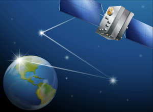
Satellite remote sensing uses satellite-mounted sensors to collect data about Earth’s surface from space. These sensors detect various electromagnetic waves, such as visible light, infrared, and microwave, to measure key environmental features like vegetation, water bodies, and urban infrastructure.
Satellite sensors work by gathering data from Earth’s surface. These sensors measure properties such as temperature, vegetation health, and water levels. After capturing the data, it is transmitted back to Earth for processing and analysis. This data can then be used in multiple applications, including environmental monitoring, urban planning, and disaster response.
There are several types of satellite remote sensing technologies that offer different capabilities:
Passive sensors detect the natural energy reflected or emitted by Earth’s surface. For example, they measure sunlight reflected by the surface, helping identify vegetation, soil moisture, and cloud cover. These sensors are typically used for environmental monitoring.
Active sensors, such as radar, emit their own energy and measure the reflected signals. These sensors are useful for gathering data in poor visibility conditions, such as through clouds or at night, and are typically used for precise surface measurements.
Multispectral sensors capture data across several specific bands, while hyperspectral sensors collect data from hundreds of narrow bands. These technologies are crucial for detecting specific minerals, pollutants, and plant types, allowing for detailed environmental analysis.
The versatility of satellite remote sensing makes it invaluable across multiple industries:
Satellites provide vital information on environmental changes, such as deforestation, urbanization, and the effects of climate change. Remote sensing data helps monitor ecosystems, track biodiversity, and assess natural resources.
Farmers use remote sensing data to track crop health, monitor soil conditions, and optimize irrigation practices. In land management, satellites are employed to assess land degradation, desertification, and urban expansion.
During natural disasters like hurricanes, floods, or earthquakes, satellite data helps assess damage, provide situational awareness, and assist with relief efforts. Remote sensing data can be a lifeline in disaster response and recovery.
City planners and developers use satellite remote sensing to monitor urban sprawl, track infrastructure development, and ensure sustainable growth. This data is essential for making informed decisions about land use and resource management.
Satellite remote sensing provides a unique ability to monitor large, inaccessible areas, delivering data that is crucial for scientific research, environmental protection, and resource management. By offering a global perspective, remote sensing allows us to better understand and manage Earth’s resources.
For more information on how satellite technology can aid your projects, visit our Satellite Solutions Page.
Send us a message,we will answer your email shortly!
TY-Space Technology (Beijing) Ltd. is professional focusing on advanced attitude optical sensors, especially Star Trackers for space industry.